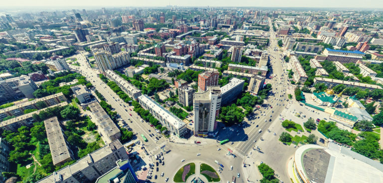
Urban areas
Solutions for urban spaces
If you are already using digital maps, you may have noticed that the information you are looking for is often either missing or has the wrong attributes. With Visimind’s GPS-based photogrammetric measuring techniques you can pinpoint the exact position of any of your data.
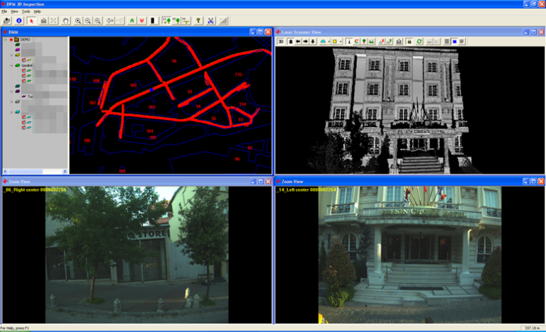
We drive or fly along the roads using cars, helicopters and aircraft equipped with multiple high-resolution cameras that are integrated with LiDAR. We collect location information using our sophisticated GPS receivers integrated with an inertial system. Our software enables the end client to view and obtain any geo-positioning information from the acquired data.
You can therefore inventory with precision, and evaluate the status of existing information. All acquired data is precisely positioned, marked on a map and laser scanned in various ways. The resulting highly accurate documentation is available at any time.
Accurate measurements can be made of elevations, bus stops and pavements etc.
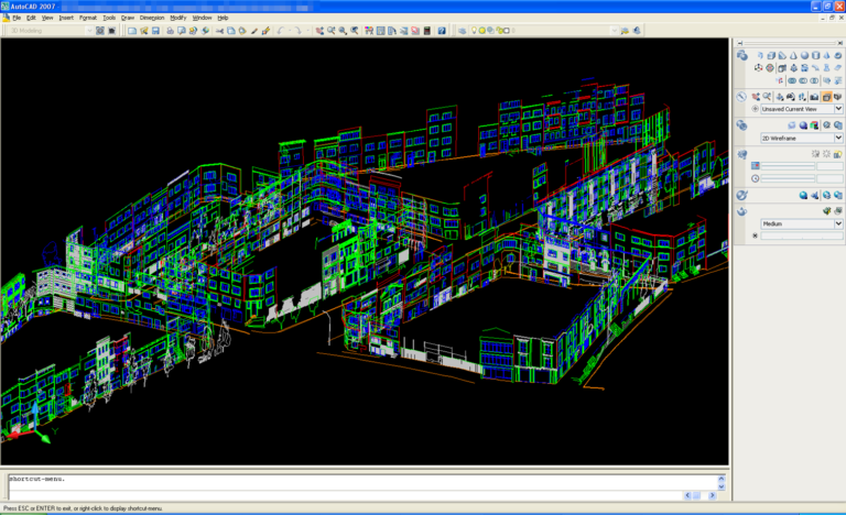
Using 3D images as a basis we can create virtual models and drawings prior to reconstructions, plans or projects.
Exact inventory can be calculated using a laser-scanned 3D model containing distances, heights, surfaces and volumes. During the flight or drive, laser scanning and all other data collection is performed simultaneously.
Experts are able to use information contained in the images regarding grids, masts etc. to make informed decisions regarding both current and planned infrastructure as well as identifying potential problems, all from their desktop. This clear and exact “picture” can also be useful as a basis for negotiations.
All the collected data can be accessed via the internet from the organisation’s computers, so that all designated personnel can have access to the images at any time.
Users will, of course be taught how to gain maximum benefit from the whole system.
Did you forget to take a measurement? What did the location actually look like?
No problem! Simply bring up the images from that location and measure directly within the image. You can quickly evaluate whether your contractors have met your specifications.
You can look at an image from many different angles and rotate the 3D model as if you were on site.
All of this information can be integrated into your information system.
You can produce an image history and evaluate processes over extended periods.