Introduction
Our comprehensive solutions enable the simultaneous analysis of information regarding the technical condition of the network and the location of objects. Full functionality is achieved through the integration of a digital terrain model, stereographic images, detailed inspection photos, thermal imaging, orthophotos, situational vector maps, cadastral maps, and industry-specific maps.
Methane detection
Visimind provides advanced inspection services for the gas sector using methane sensors mounted on drones as well as dedicated systems for helicopters. Our solutions enable fast and precise detection of gas leaks over large areas, minimizing environmental and operational risks.
By applying Remote Methane Leak Detection technology, we deliver accurate data on the location and intensity of emissions. The drone-based system is ideal for local inspections in hard-to-reach or hazardous areas.
For large-scale projects, we deploy integrated measurement devices for helicopters, allowing rapid scanning of hundreds of kilometers of gas infrastructure. Visimind’s comprehensive reports and analyses support operators in efficiently managing their networks and reducing gas losses, while ensuring compliance with the EU Methane Regulation and the Global Methane Pledge for greenhouse gas emission reduction.
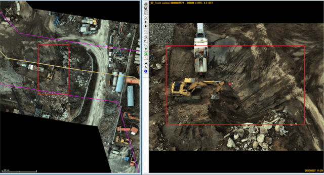
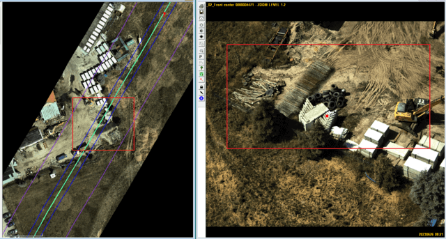
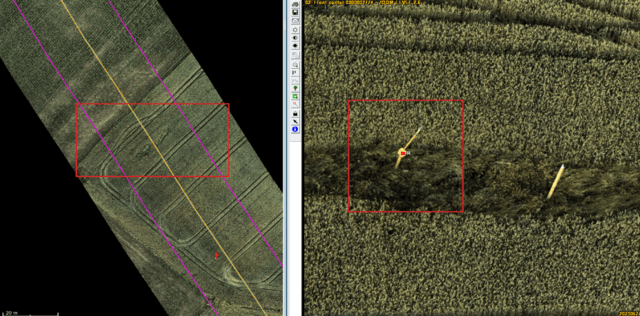
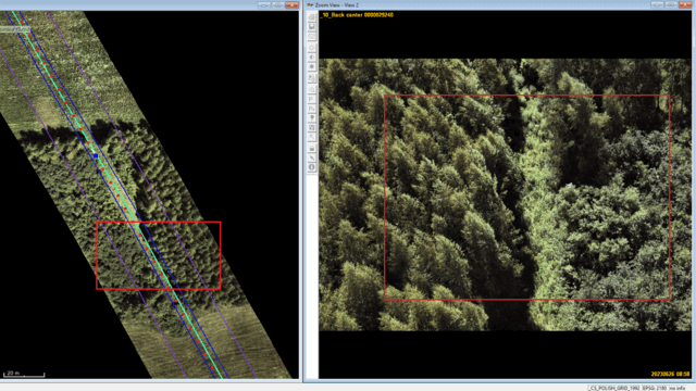
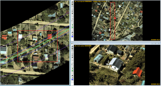
Inspection of the gas network within the technological corridor
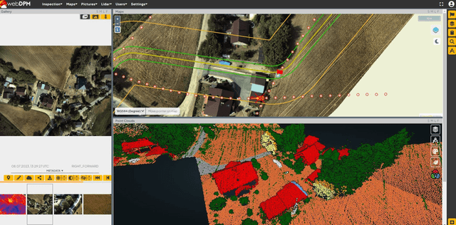
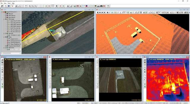
We conduct visual inspections of the gas network and its components using data collected from images taken during flights of our acquisition platform (drone, helicopter, airplane). These images serve as the basis for analyzing the condition of the gas infrastructure and identifying any potential faults and safety violations.
During the inspection, specially trained personnel evaluate the images, paying particular attention to any damage, leaks, or other irregularities. Images showing faults are compiled into a comprehensive report on the pipeline's condition, providing the client with valuable information for quick response and planning of repair actions.
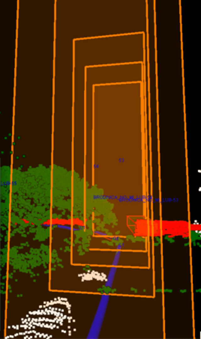
In the course of the gas network inspection, special attention is given to identifying threats to the network's operation. For example, detecting construction activities or other objects within the gas pipeline corridor that may pose potential risks to the safety and stability of the infrastructure.
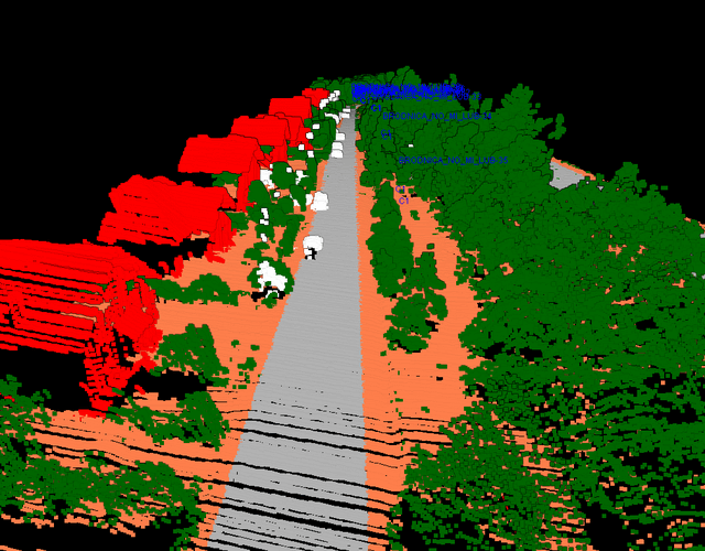
Digital Mapping
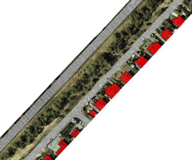
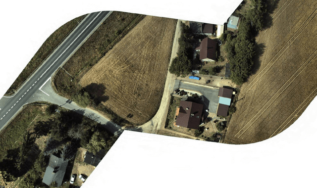
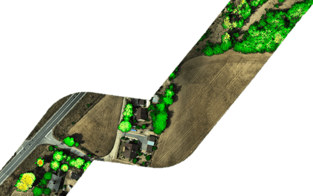
Our products include a comprehensive range of maps, such as vegetation maps, orthophotos, and classification maps. This diverse set of maps presents various data interpretation results, providing versatile tools for land analysis, planning, and decision-making across different fields and industries.
- Classification Map - we visually interpret the three-dimensional point cloud and classify objects such as buildings, roads, water bodies, and other elements significant from the perspective of a gas network operator. These maps are extremely helpful for managing infrastructure and assessing areas for various purposes, from ecology to spatial planning.
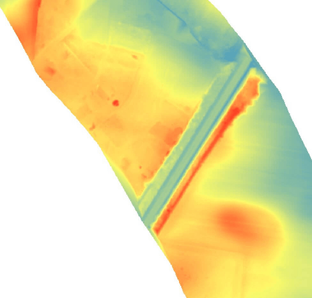
- Orthophoto Map - our orthophoto map provides a detailed visualization of the terrain, including all infrastructure elements and vegetation. It is a valuable tool for industry professionals as well as for those involved in spatial planning or environmental assessment. It offers comprehensive information about the terrain's topography, building structures, and green areas near the gas infrastructure.
- Raster Vegetation Map - the visual interpretation of a three-dimensional vegetation model near the gas pipeline provides valuable information about the condition of the protective zone. With two-dimensional raster maps, users can accurately analyze and plan maintenance activities for the protective zone using any GIS software.
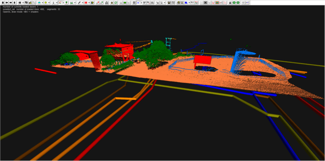
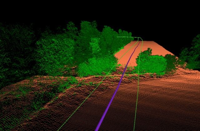
3D Terrain and Architecture Modeling Using LiDAR Technology
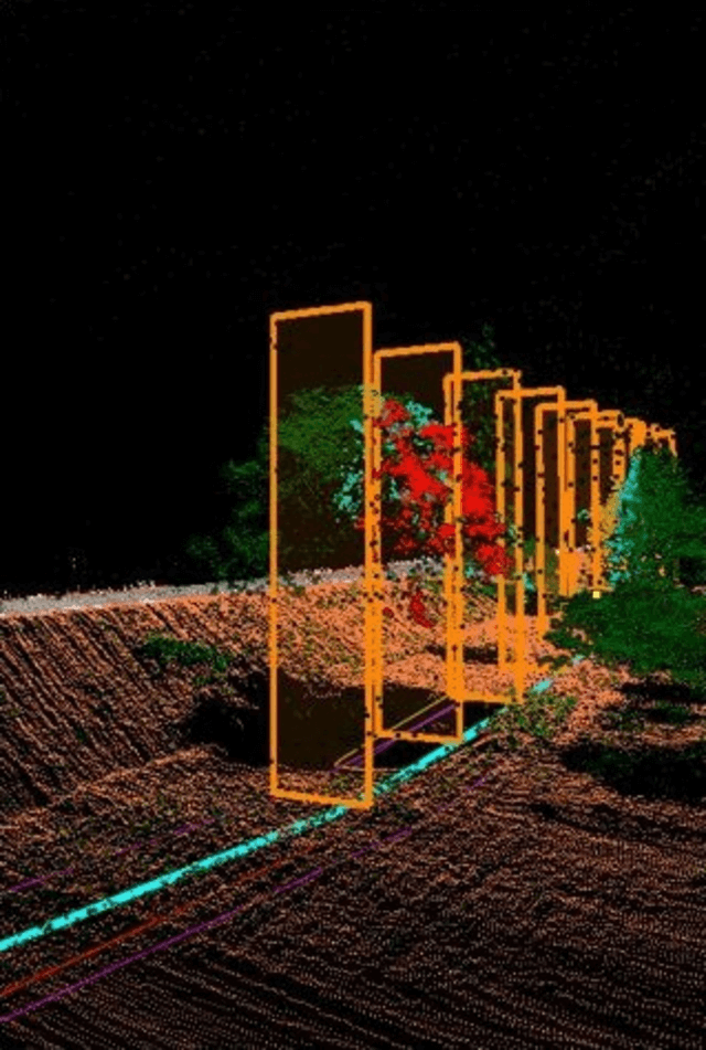
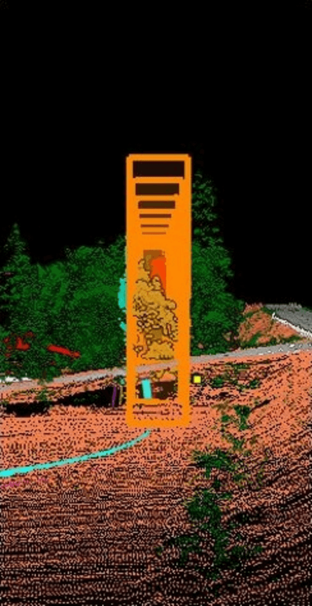
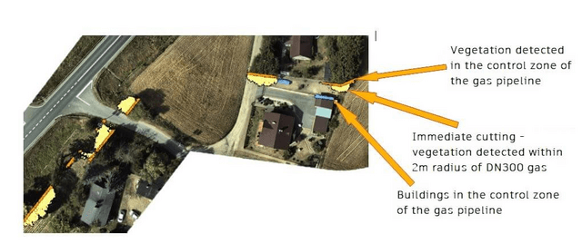
Terrain modeling based on point cloud data from airborne LiDAR scanners is a key component in developing collision maps for gas pipelines. With this advanced tool, it is possible to accurately represent terrain and building structures in a three-dimensional space, enabling precise analysis of the gas pipeline's controlled zone.
Parameterizing the detection range of proximity to the gas pipeline is a crucial aspect of this process. Using advanced algorithms for geospatial data analysis, it is possible to accurately determine distances between the gas pipeline and other objects, facilitating the identification of areas with potentially increased collision risk.
Furthermore, automatic detection of objects and vegetation in the pipeline zone allows for cost optimization of clearing works and contributes to increasing safety levels. By utilizing advanced data analysis and 3D modeling tools, gas infrastructure operators can make informed decisions regarding the management and maintenance of the pipeline's protective zone, minimizing the risk of potential threats and ensuring the reliability and integrity of the network.

Optimization of the pipeline environment management system and safety
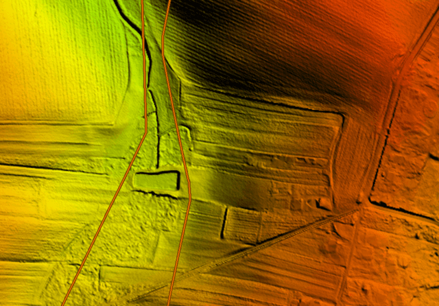
This is a crucial action in ensuring the reliability and safety of gas infrastructure. Utilizing data from Light Detection and Ranging (LiDAR) technology is an extremely effective tool in this process.
Our data acquired through LiDAR technology allows for obtaining precise information about the terrain and structures around gas pipelines. This enables accurate modeling of the environment, identification of potential threats, and optimization of the monitoring and safety management system.
By analyzing LiDAR data, gas infrastructure operators can precisely determine the terrain's topography, identify objects near the pipelines, and monitor changes in the surroundings. This enables quick response to any changes and minimizes the risk of potential threats such as collisions or damage.
By leveraging data from LiDAR technology, the pipeline environment management and safety system becomes more efficient and precise, contributing to ensuring the reliability and safety of the entire gas infrastructure.
Summary
Our data allows for precise monitoring and analysis of the gas infrastructure's condition, enabling better planning of maintenance and modernization activities. Additionally, through the use of modern technologies such as spatial data analysis, our solutions can anticipate and prevent potential problems, leading to increased operational efficiency and cost savings for our clients.
Our primary goal is to provide valuable data that contributes to improving performance, reducing inventory time, solving potential issues, and optimizing work processes using modern technologies. With our solutions and services, our clients can achieve better outcomes in managing their gas infrastructure.
As a result, our services support clients in achieving their strategic business goals by providing them with accurate, up-to-date, and valuable data and tools for analysis and utilization.