

Solutions for urban space
Visimind provides services in urban areas for documentation. Our solutions are used in the process of urban development planning, the inventory of buildings and objects of historical interest. The data can also serve as a contribution to the creation of noise maps.
Our offer
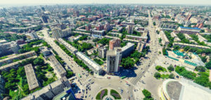
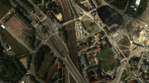
Information about the land surface is derived from a moving vehicle: helicopter, car, RPAS or airplane, using digital sensors such as digital high speed camera, thermal iamging camera, laser scanner or hyperspectral camera. Detailed illustration of facades of buildings, streets and green areas are collected from different angles. In case of an air based operations, photogrammetric material is produced in three-dimensional numerical models, orthophotomaps of cities and their environment, digital elevation and acoustic maps, assumptions used for purposes of planning the deployment of the GSM infrastructure transmitters.
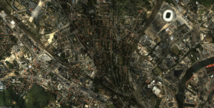
Visimind company boasts an inventory of the old city of Istanbul, including the facades of buildings 48 000 400 km along the city streets. Laser scanning and digital photographs were taken from the deck of a car with a navigation system (INS+GNSS) to allow the location of objects in a coherent system of geographical coordinates. Based on the obtained prosessed data, accurate 3D documentation of the Islamic architectural monuments was developed. Through integration of photogrammetry and laser scanning, it was possible to cover the 3D model with natural colors from these images. Visimind’s project by using this method, was implemented in a record speed of 6 months.
You are welcome to use our services, we will prepare an offer specifically for your business.