OxTS xNAV650
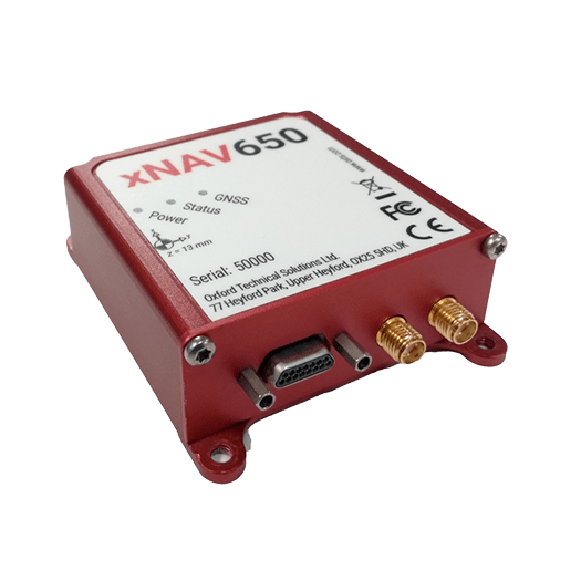
The xNAV650 is one of OxTS’ smallest and lightest Inertial Navigation Systems (INS). The device makes use of cutting edge GNSS and IMU technology, to deliver the precision and reliability OxTS’ customers have come to expect – ideal for SWaP constrained applications.
Despite combining the latest MEMS inertial sensor technology with survey-grade GNSS receivers, the xNAV650 INS is also our most competitively priced INS to date.
The xNAV650 provides surveyors with reliable and precise navigation data – even when budgets are limited.
Specification
Positioning: GPS, GLONASS, BeiDou, Galileo
X, Y Position RTK: 0.02 m, PPK – 0.015 m
Roll & Pitch: 0.03°
True Heading: 0.1°
Dimensions: 77 x 63 x 24 mm
Weight: 130 g
Input Voltage: 5 – 30 V DC
Power Consumption: 4 W
Internal Storage: 32 GB


RT3000 v4
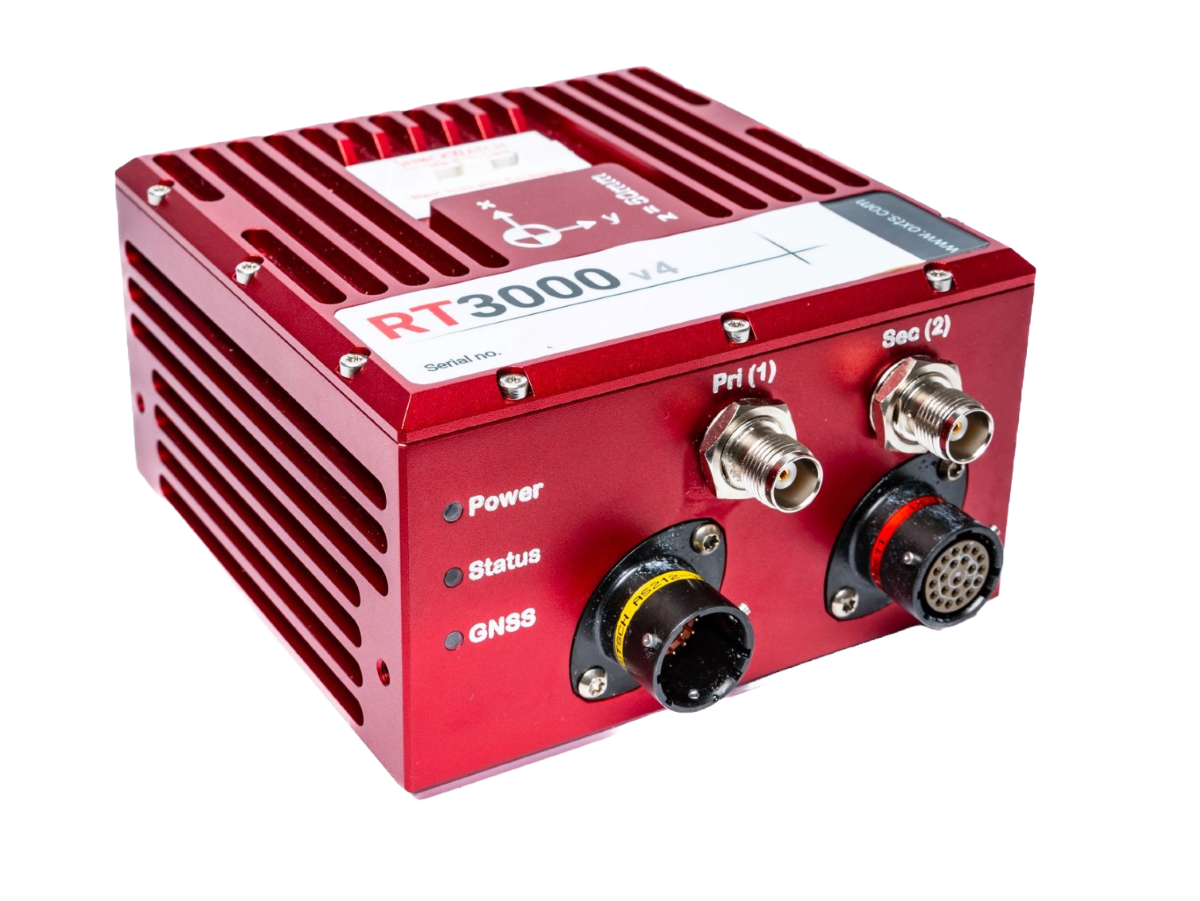
Combining survey-grade GNSS positioning with OxTS’ best ever inertial measurement unit, the RT3000 v4 offers a robust, out-of-the-box navigation solution for uninterrupted position, orientation and motion data in all environments.
By combining two survey-grade GNSS receivers with OxTS’ latest IMU10 inertial technology, the RT3000 delivers consistent, reliable and accurate position, orientation and dynamics data in all environments.
Ship your RT3000 v4 globally without requiring export licenses. Leveraging advancements in OxTS’ navigation engine the RT3000 v4 achieves a new level of performance using components that are not subject to export controls.
The RT3000 v4 gets to specification within three minutes of low dynamic movement means you no longer need to find the time and space required for high-dynamics maneuvers.
Avoid the hassle of subscription license renewals with OxTS’ complimentary post-processing tools. NAVsuite, contains all of the applications you need for device configuration, real-time monitoring, post-processing and data visualization.
Specification
Positioning: GPS, GLONASS, BeiDou, Galileo
X, Y Position: RTK – 0.01 m, PPK – 0.01 m
Altitude: 0.012 m
Velocity: 0.025 km/h
Roll & Pitch: 0.010°
True Heading: 0.040°
Slip Angle: 0.050°
Dimensions: 120 x 120 x 71 mm
Weight: 690 g
Input Voltage: 10 – 48 V DC
Power Consumption: 6 W
Internal Storage: 32 GB
Onboard Data Logging Rate: 3 MB/s
Environmental Protection: IP65
xRED3000
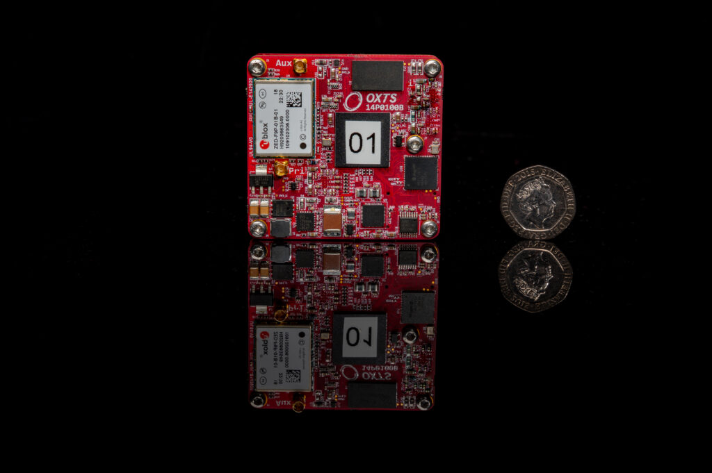
Measuring just 53.6 x 50.6 x 9.5 mm and weighing only 20 grams, the xRED3000 is suitable for land- and air-based applications. Combines two survey-grade GNSS receivers with OxTS’ latest IMU10 inertial technology to deliver uninterrupted position, orientation and dynamics in all environments. Outputs real-time data at 100 Hz (250 Hz optional) via ethernet and serial.
The xRED3000 gets to specification within three minutes of low dynamics movement. Increases flight time efficiency for aerial applications and eliminates space requirements for land-based warm-ups.
Avoid the hassle of selling third-party subscriptions with your product with OxTS software suite, NAVsuite, included free-of-charge. NAVsuite contains the essential applications your customers could need for device configuration, real time monitoring, post-processing and data visualization.
Optimize your unit cost to include only the functionality you need. Use as a second-source option with no minimum order quantity and volume discounts available. Add additional functionality and firmware upgrades to your xRED3000s in the field with remote upgrades.
Specification
Positioning: GPS, GLONASS, BeiDou, Galileo
X, Y Position: RTK – 0.01 m, PPK – 0.01 m
Velocity: 0.05 km/h
Roll & Pitch: 0.020°
True Heading: 0.050°
Dimensions: 54 x 51 x 10 mm
Weight: 20 g
Input Voltage: 5 – 60 V DC
Power Consumption: 4 W
Internal Storage: 32 GB
Onboard Data Logging Rate: 8 MB/s

